
Left rectangle ads redesigned


Robert Ripps book
History of Tribeca Buildings
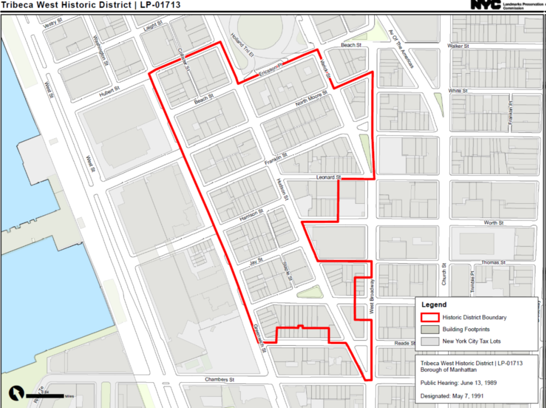
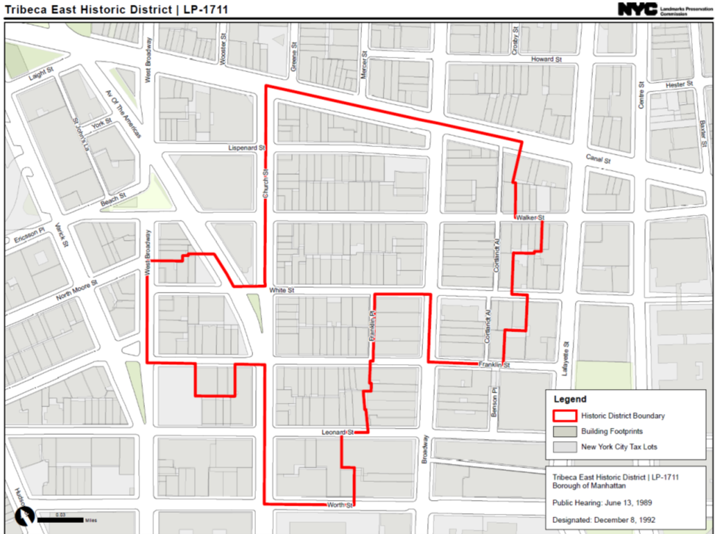
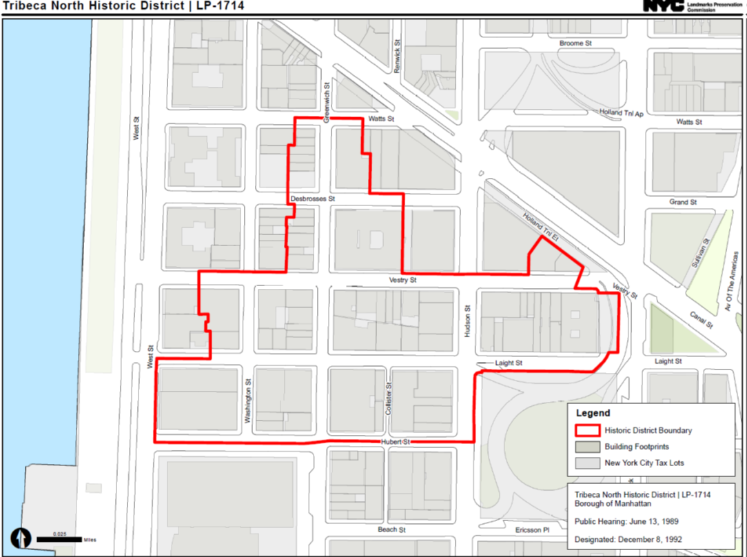
Defining the historic boundaries of Tribeca
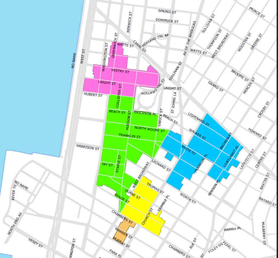
After a discussion in comments about the boundaries of Tribeca proper — generated by this post on the microneighborhood that residents there call Triberia — Tribecan Amy Bonomi sent along the map above, noting that the Tribeca East Historic District does in fact extend east of Broadway, making it Tribeca by definition.
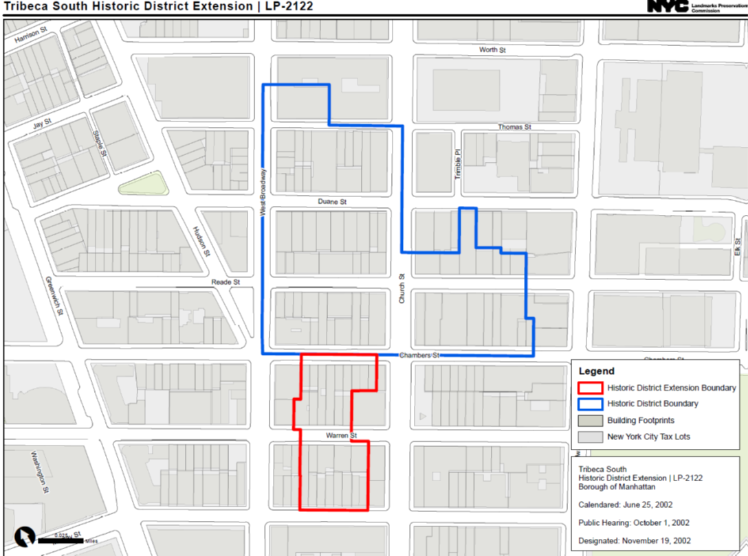
I figured that was a good jumping off point for a review the historic district maps — we have four districts — and the individual landmarks as well — we have about 30. To follow are the maps. See the individual landmarks in map form here, or in a list below.

Barclay-Vesey Building (Verizon or 100 Barclay)
22 Barclay Street | Saint Peter’s Roman Catholic Church
75 Murray
160 Chambers (Engine Company 29)
Woolworth Building
25 Park Place (22 Murray)
256-257 Broadway
122 Chambers (52 Warren)
105-107 Chambers (89 Reade)
273-277 Broadway
287 Broadway
100-104 Duane Street | Fire Engine Company No. 7 / Hook & Ladder Company No. 1
305 Broadway (aka 305-309 Broadway, 91-99 Duane Street) | Langdon Building
311 Broadway Building
8 Thomas Street | David S. Brown Store
New York Life Insurance Company Building
359 Broadway
361 Broadway
55-57 White Street (aka 6-8 Franklin Place)
46 White | Woods Mercantile Buildings
Long Distance Building of the American Telephone and Telegraph Company (32 Sixth)
2 White Street House
60 Hudson Street | Western Union Building
39 Worth Street Building
41 Worth Street
175 West Broadway Building
25-41 Harrison
Condict Store — 55 White
451-453 Washington Street – Fleming Smith Warehouse
1 Comment
Comment:
Medium rectangle #1 (top)

Right column rectangle ads


Restaurant guide icon


Who’s going to tell the Jenga building (56 Leonard) residents they aren’t in Tribeca?