


Left rectangle ads redesigned

History of Tribeca Buildings
A progress report on the work in north Battery Park City
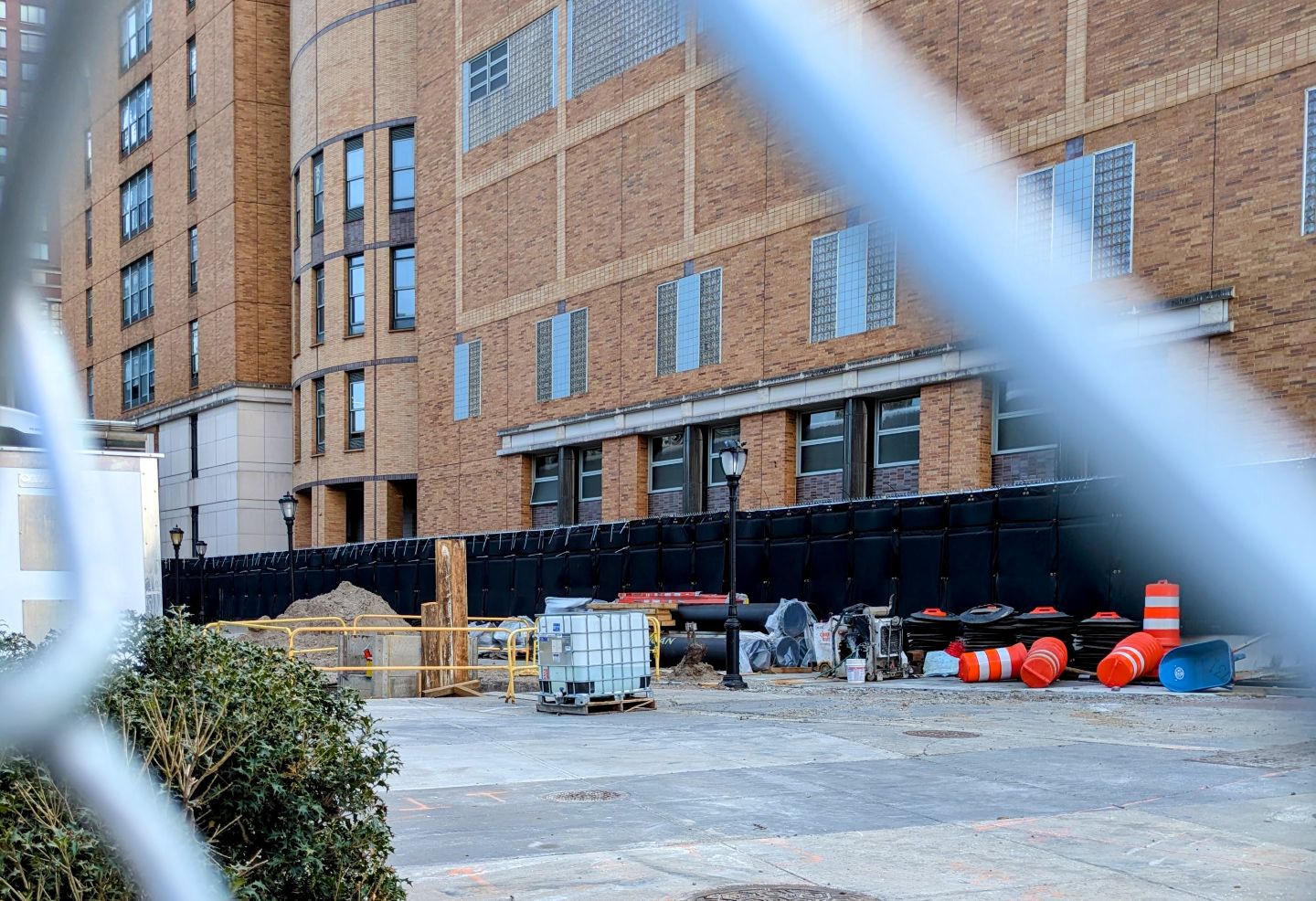
Construction on West Street
ICYMI, the Battery Park City Authority has begun construction designed to address resiliency against storms on the northern parts of their property, meaning Rockefeller Park at the end of Chambers down to Murray, plus the esplanade north of Stuy and River Terrace. The project is huge and will not only stretch over years, but will also extend into Tribeca along West Street and on Harrison up to North Moore.
This post from December has more of an overview of the construction that will go on for the next four years.
The info below is just a small update on the work you are currently seeing behind construction fences along the bike path and on the north side of Stuyvesant High School. As I get more details — these are just concept plans — I will add more posts.
ROCKEFELLER PARK
The work in the park proper does not start until spring 2028. That will last two and a half years once it begins. The BPCA will be installing a Flood Barrier System along the west side of River Terrace from Chambers Street to Rockefeller Park Playground. Anticipated construction impacts include noise from 7a to 6p, visual changes to the area due to construction activity, closure/reconfiguration of ballcourts and playground, and the temporary closure of the east entrance to the park house. See details on that here.
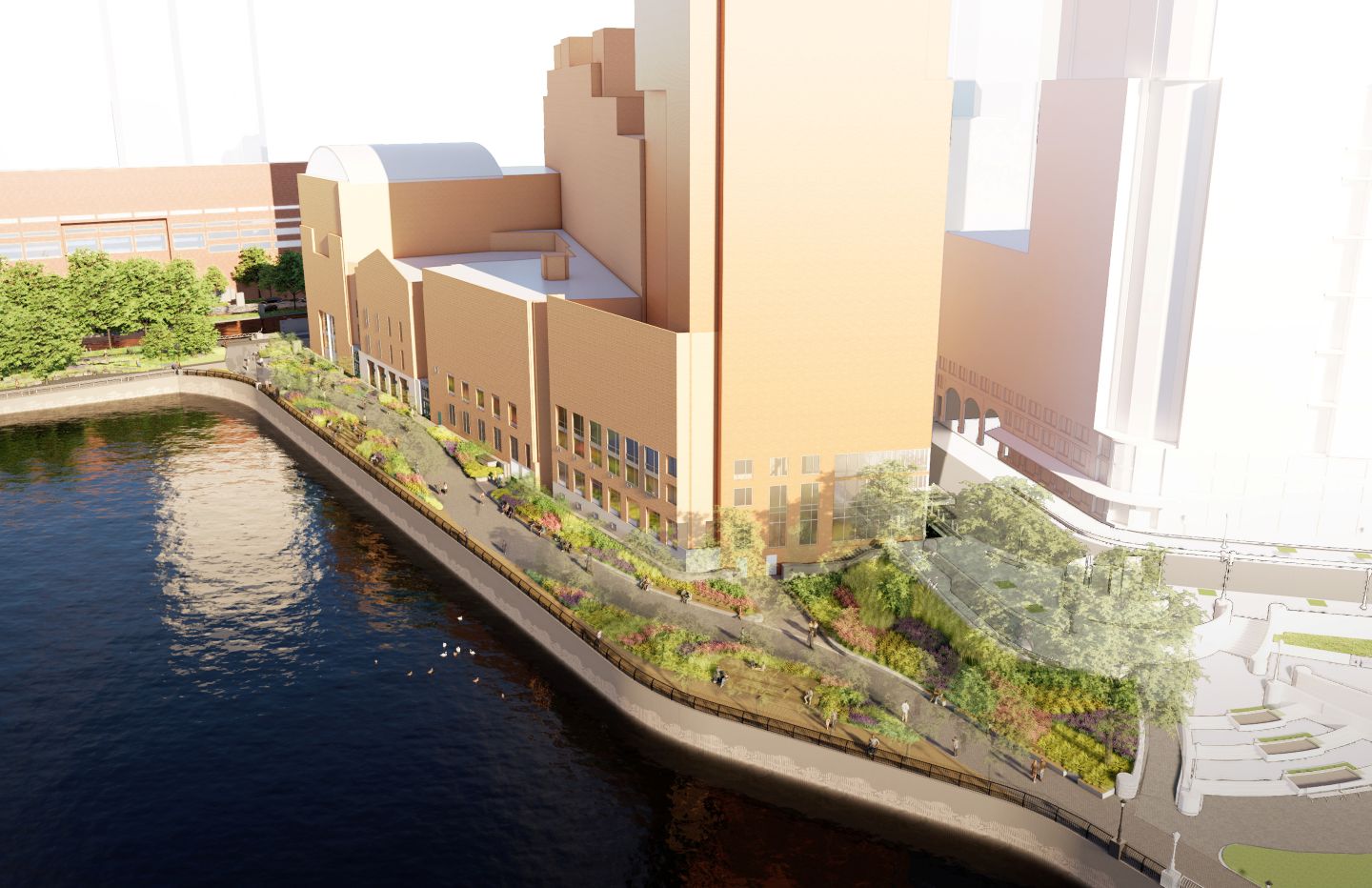
North Esplanade rendering
NORTH ESPLANADE
This is the stretch of Battery Park City’s parkland that runs along the north side of Stuyvesant on the bulkhead (you can also think of it as the south side of the marina area between Battery Park City and Pier 25). There is a corner where BPCA property meets Hudson River Park and that has been redesigned to have a curve, though the images here are a bit vague.
This area is currently projected to be closed through the second quarter of 2030. The rendering is above. The concept plan is below.
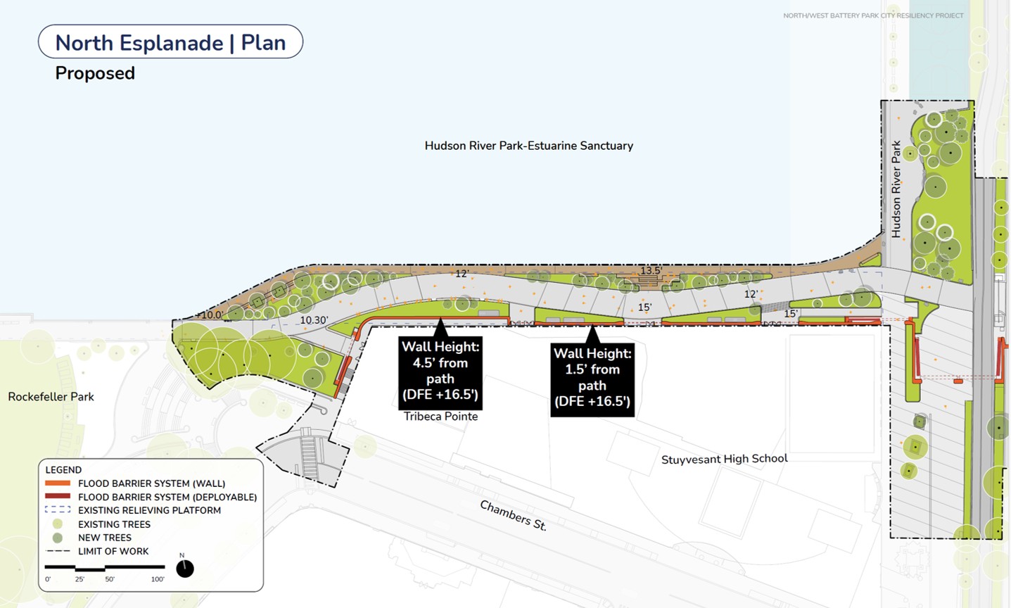
North Esplanade Plan
WEST STREET, HARRISON STREET and NORTH MOORE STREET – AKA REACH 1
The Battery Park City Authority has labeled these construction areas as “reaches,” and Reach 1 crosses Route 9A, heads north to North Moore, and then runs along the south side of North Moore, along Independence Plaza, all the way east to Greenwich Street.
That area is currently projected to be under construction in phases (not the whole stretch at once) from this coming September through August 2030. The concept plans for West Street — broken up to have a West Street North Plan and a West Street South Plan — are below.
The general idea: the BPCA will construct both permanent flood barriers and deployable ones. The permanent ones will run along the east side of West Street up to North Moore, then run along North Moore up to around the entrance to Independence Plaza at 80 North Moore. Along that route, both across Route 9A and across Harrison Street, there will be deployable flood barriers that get inserted when the waters rise.
In the case of Harrison and North Moore, the wall heights will be 9.6 feet above grade.
The Battery Park City Authority is still finalizing agreements with external stakeholders in that area — meaning the property owners along West Street. That includes BMCC, Independence Plaza, and the NYC Department of Transportation.
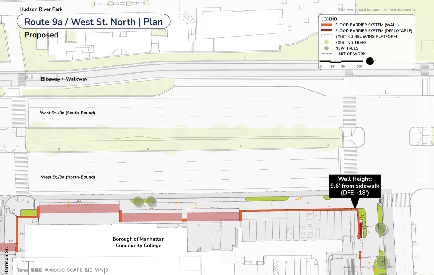
Route 9A / West Street Plan | Harrison to North Moore
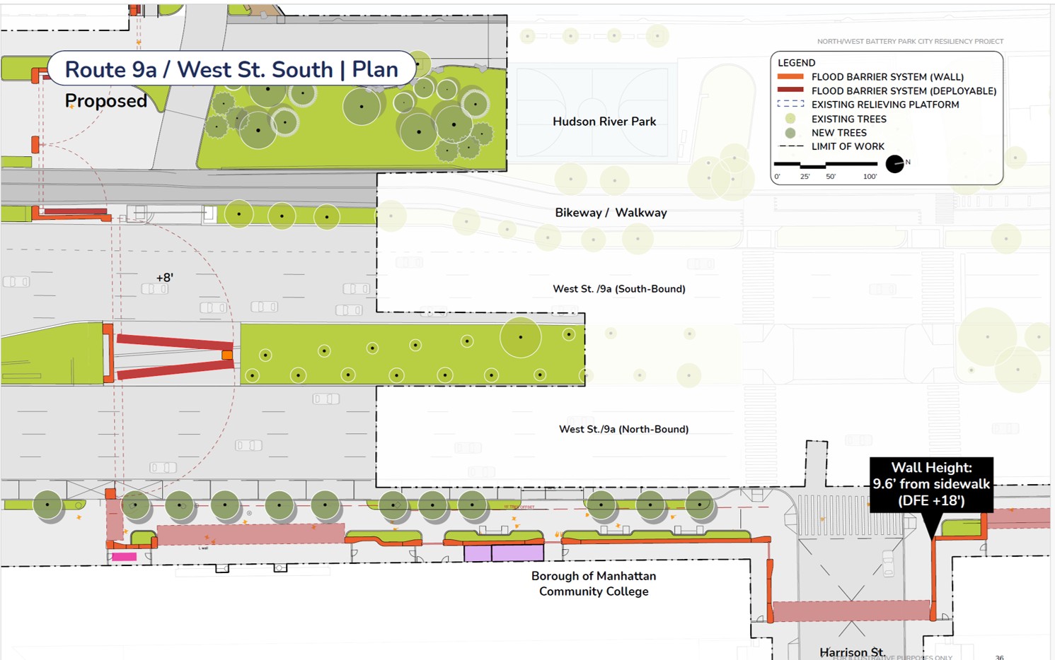
Route 9A / West Street Plan | Chamber to Harrison streets
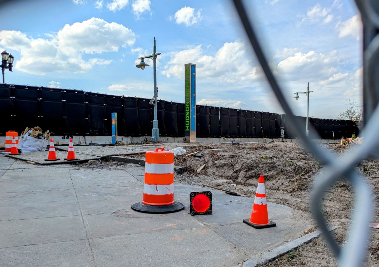
Construction on West Street
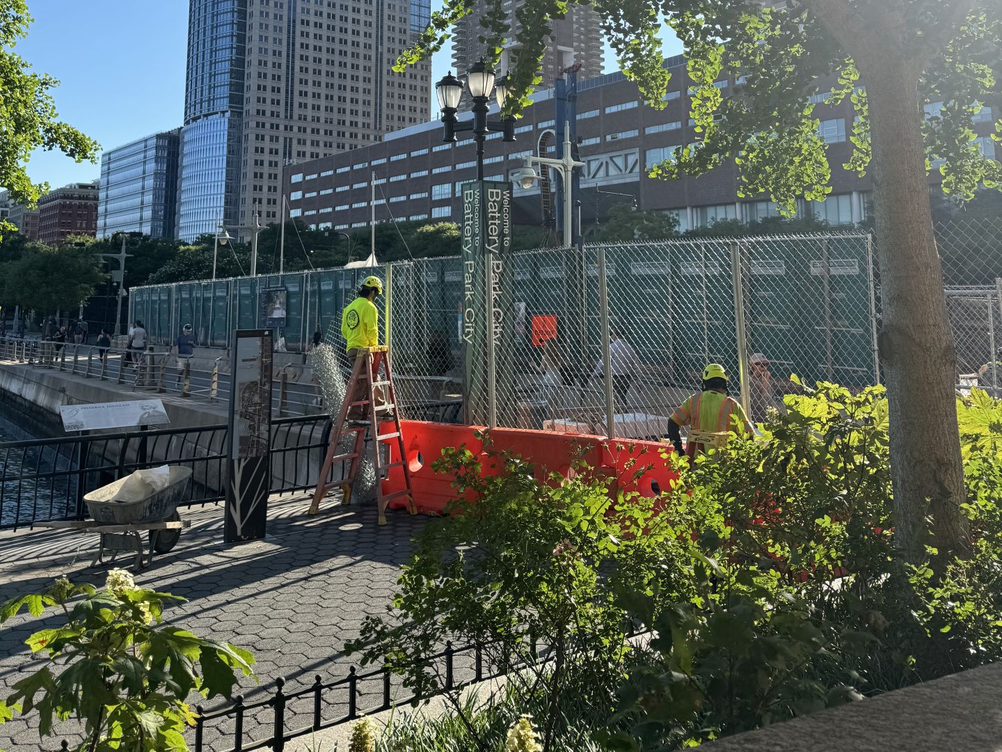
Construction on North Esplanade
12 Comments
Comment:
Medium rectangle #1 (top)

Right column rectangle ads



Restaurant guide icon


I completely fail to understand how it’s legal to implement this plan, which walls off everything south of Harrison to protect that area specifically and leaves known flood zones like Canal, Vestry, Laight, etc. immediately to the north completely unprotected and arguably at greater risk since that blocked water needs to go somewhere.
Thank you. Agreed!
In Battery Park City, I weekly see moving vans moving people out. Is a project manager keeping track of how many people are leaving? The people that have left this area were spending money in local stores and restaurants. How long will those be able to survive?
They have completely accomplished flood abatement for the lower west side of Manhattan up to North Moore street which FEMA tells us is a spectacularly vulnerable flood zone. All of the expense, the mature tree felling, the disruption of our enjoyment of this green space, will usher in terrible flooding in North Tribeca, SoHo and points north. Who approved this?!?
Very nice. What about the streets and subway that flood like inland seas?
This will go down as one of the largest financial boondoggles in the history of NYC perpetrated by Albany based crony-capitalists greenwashing their crimes.
Anyone who lives in the neighborhood knows the ONLY downtown neighborhood virtually untouched by Sandy was BPC (remember when they evacuated us to parts of the city that lost power while BPC still had it!!).
This will certainly last longer than 4 years to finish, cost $millions ($Billions?) more and do absolutely zero to protect the areas more prone to flooding, while destroying livelihoods and property values.
It’s COVID lockdowns x20 for BPC businesses (Liberty Bistro will be gone in a year, and PJ Clarkes likely a quick follow) and the main reason to move the BPC – the wonderful community and parks will be destroyed.
Shame, shame, shame.
I could not agree more. What a waste of taxpayer dollars that will ruin a wonderful, family-centric area and do nothing useful if/when completed. An absolute shame. I signed a petition to, at least, save mature trees but don’t think it garnered enough signatures. This is Albany nonsense at its most wasteful.
Don’t ask me how I have this connection, but I’ve spoken to the construction manager 1:1 before (he didn’t know who I was or that I lived in the neighborhood), and when I asked how long this phase of the project would take, he said “oh it’ll definitely be 10 years, not five. And it’ll cost $3B, not $2B once it’s all said and done.” I also have a witness to this exchange, FWIW.
After the disastrous Wagner Park timeline (and $300M to build a two story building on a hill that took 3 years and still doesn’t have a restaurant), and the flood wall thats now three years in and still somehow not complete, I believe him and hope someone investigates this travesty.
Unfortunately this is true about virtually every public works project in the city. Take a walk around all of the road construction, there is no outside supervision of the work being done. Most of the day is spent uncovering and covering the same holes in the street. The amount of waste is mindboogling, and a big reason we are the most expensive place to live with the highest taxes.
Oh, and the “storm walls” have got to be the most unattractive design element ever perpetrated on NYC.
Expect a robust business in graffiti clean-up (also likely paid to NYC businesses connected to the BPC Board).
This smacks of cronyism to such a degree that I wonder why Tish James has not yet initiated an investigation.
As someone living in the area for 6 years now, this concerns me. I am worried that some of my favorite parts about living in this neighborhood are being disrupted…and for a very, very long time. What are we supposed to do? It seems this is going to completely change things around here…