
Left rectangle ads redesigned

Robert Ripps book
History of Tribeca Buildings
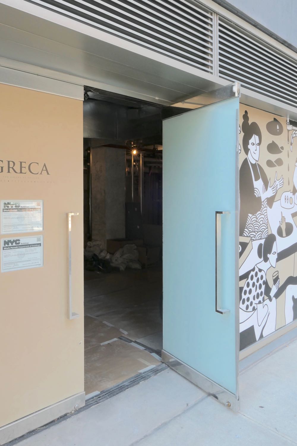
Seen & Heard: Peeking Inside Greca
••• If you were hoping that Acappella would reopen at 1 Hudson, sorry: The stop-work order posted on the door is for capping and removing the gas line without a permit.
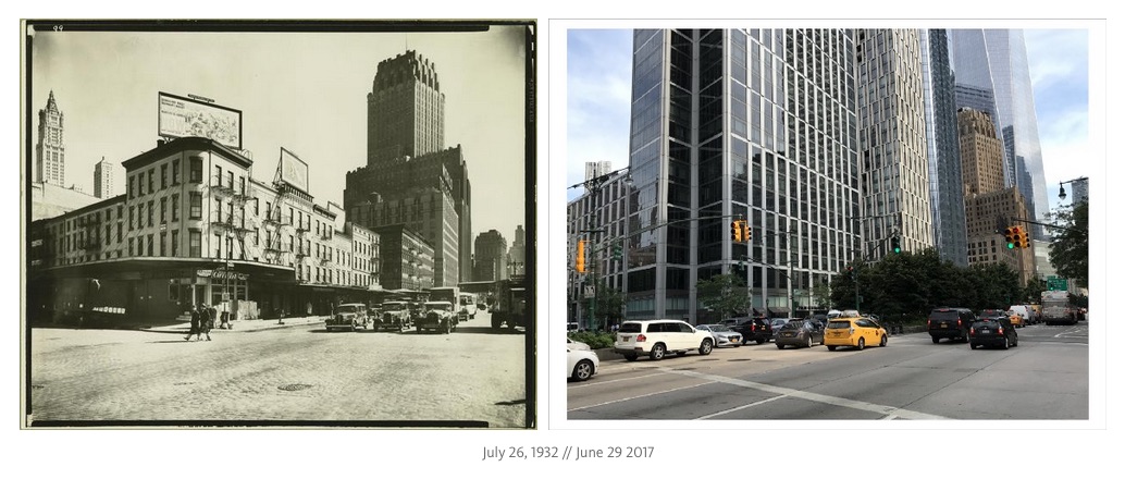
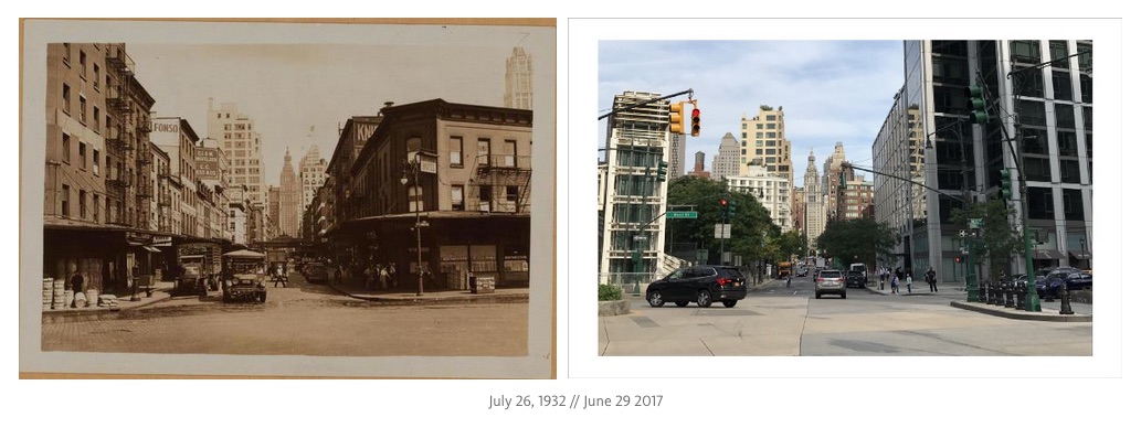
 ••• While reading part 1 of Ivan Kosnyrev’s Tribeca: Then & Now series, M. thought it was odd that the southeast corner of Chambers and West would look so different in photo #7 (taken in 1936; first image below) and photo #8 (taken in 1932; second image). M. suggested that #8 wasn’t Chambers, but Ivan and I feel confident it is—the Municipal Building is dead center in the background. But #7, we realized, could be Warren, rather than Chambers. 100 Barclay certainly does look rather close…. Unless anyone out there says otherwise, I’ll update the original post.
••• I noticed yesterday (but it may have been the case for a while now) that the Wichcraft at Greenwich and Beach is no longer open on weekends.
••• It doesn’t look like Greca restaurant is opening imminently.
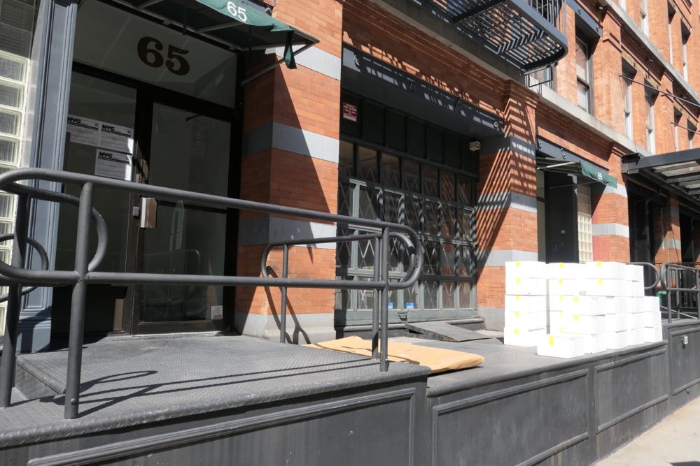
 ••• I had been wondering what was happening on the ground floor of 65 N. Moore. Turns out Grace Hightower’s company, Coffee of Grace, is based there. Back in 2013, she mentioned plans to open a Tribeca store/café—no clue if that’s still in the cards.
2 Comments
Comment:
Medium rectangle #1 (top)

Right column rectangle ads


Restaurant guide icon


Re #7 – It is between Warren & Murray, by Berenice Abbott, 1936. Compare with:
The Miriam and Ira D. Wallach Division of Art, Prints and Photographs: Photography Collection, The New York Public Library. “West Street Row: V, between Warren & Murray Streets, Manhattan.” The New York Public Library Digital Collections. 1936. http://digitalcollections.nypl.org/items/510d47d9-4edb-a3d9-e040-e00a18064a99
#8 is definitely Chambers.
I see how #7 is captioned on the NYPL site, and agree it is actually Warren Street. 140 West (the Verizon building is between Vesey and Barclay, the “union” building (World Telegraph? in photo) is between Barclay and Murray, so logically two more streets would make it Chambers street (https://goo.gl/maps/neqdYwBQbgt).
However, the current alignment of Murray street is different than it was when the photo was taken. At that time it was parallel to Warren, and Park Place continued to West street, but that section was called Robinson street in 1854 (http://maps.nypl.org/warper/maps/7304#Preview_tab).
Bernice Abbott’s (who took that picture) book, Changing New York, published in 1936 (and reprinted 1997) clearly shows the location of the image on a map (p. 124) as the middle of West street at Warren. It also shows Robinson street, which was by then called Park Pl. I am guessing the moving of Murray street and the erasure of that stretch of Park Pl occurred some time in the late 60’s or early 70s when most of western Washington Market was destroyed (and other streets like the stretch of Washington, and western ends of Beach, Franklin, Jay, Duane, and Reade, as well as Caroline street were demapped).