
Left rectangle ads redesigned

Robert Ripps book

History of Tribeca Buildings

Battery Park City Authority workshops resiliency plans for Tribeca
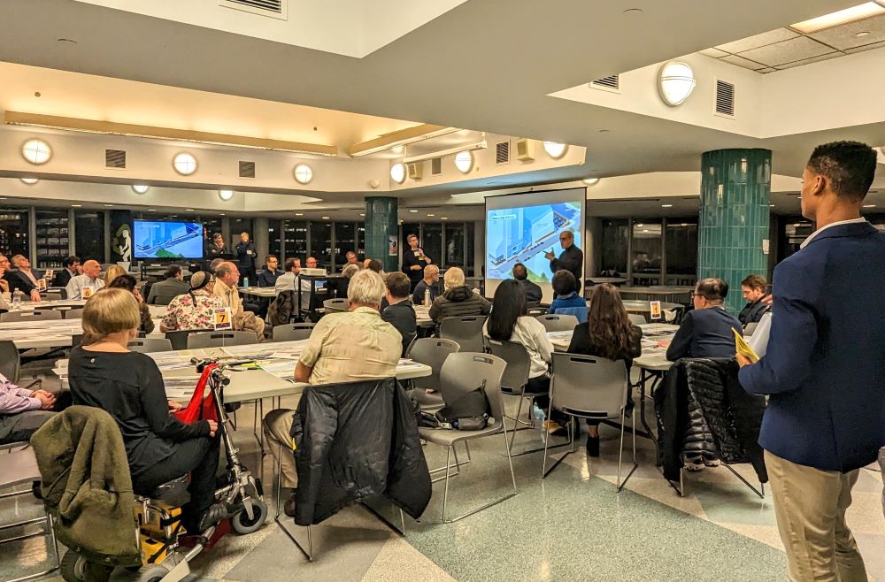
The Battery Park City Authority is hosting workshops on the redesign of all of its parks along the river and before I go on, I will say that if you are at all invested in this issue this is totally worth your time. I prioritized the Tribeca section and info on that is below, but there are two more meetings coming up: March 6 for the South Esplanade and the South Cove and March 15 for North Cove. I missed the one for Rockefeller, but you can see those plans here.
The meetings are well run and organized, and you will have access to the designers, engineers and BPCA officials at your table. They break the attendees up into small groups who talk, round-table style, about the project, which has been divided up into what they call “reaches” or segments.

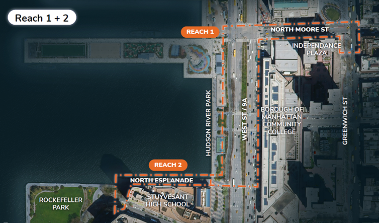
This meeting was for Reach 1 & 2: Tribeca and the esplanade running on the north side of Stuy; So here goes. See the full presentation for this segment here.
THE WHY
Battery Park City is trying to protect its buildings and businesses from future flooding. For this section, they plan to reinforce the bulkhead that is the north wall of Stuy with a steel wall. To do that you have to rebuild the platform anyway — you can’t surgically stitch around it.
They then want to essentially wall-in Battery Park City from the north, so that water coming from the Hudson immediately north of their property will stay out. That requires building a wall from Stuy to N. Moore through either Hudson River Park or the median on West Street, then running another wall east on N. Moore to the high ground at Greenwich. (Yes, it’s kind of nuts.)
THE SCHEDULE
They are currently in the design phase, which should be complete by fall 2024. Construction would start then and continue until 2027.
THE PLAYERS
BPCA has hired the design/build team of Turner/EE Cruz with urban design by BIG (Bjarke Ingels Group); landscape architecture by SCAPE; engineering by Arcadis. When you are at the meetings, you are speaking directly with partners at these firms, as well as representatives of the builders and the authority. The access is pretty incredible.
THE PLANS
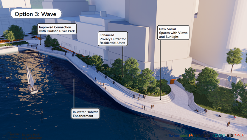
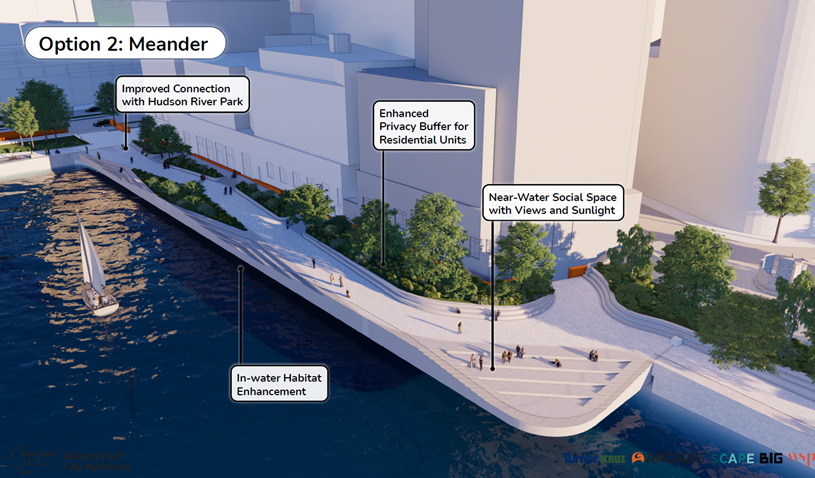
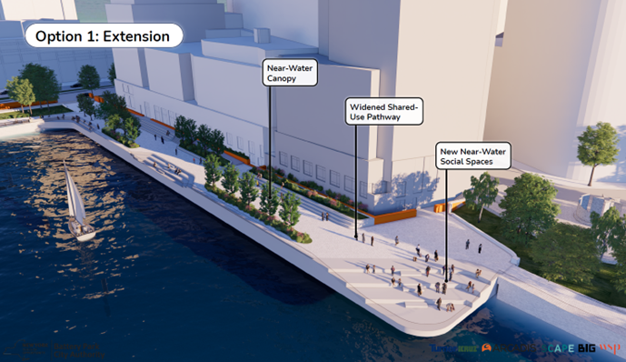
Reach 2 – North Esplanade
There are three options and I won’t bother to describe them — review these renderings and go back to the PDF above for more details. They said the cost is similar for all three; option 3 requires less permitting.
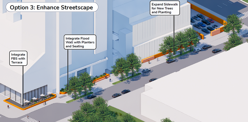
Reach 1 – Tribeca streets
While Battery Park City can figure out how to justify all these plans on their own property, moving into the streets of Tribeca AND Hudson River Park is a whole other thing. Keep in mind that their goal is to protect Battery Park City alone; they claim that this plan will protect some of Tribeca as well, but you would have to dig really deep into flooding studies and wave studies to make sure this would all work. Of course anything north of N. Moore is on its own.
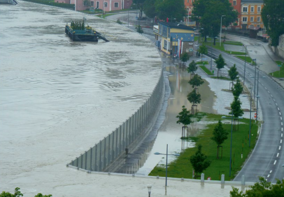
To give a sense of what they are thinking about, they included a photo of a 2013 flood of the Danube in Austria, see below. Here is the summary:
- 9-foot-high concrete wall in Hudson River Park / West Street median up to Harrison with deployable metal gates at the crosswalks
- The wall would then snake along the eastern side of the highway to N. Moore.
- Concrete wall on the south side of N. Moore either along the edge of the curb or along the edge of IPN to Greenwich. There are three plans for this; see the proposal for details. The rendering above is the wall along the building edge.
MY TAKEAWAY
There is not a “no build” option that they are presenting here — just options for how they build it. But as a neighbor, it is still worth engaging, especially for the three options along N. Moore. Neighbors should make sure the wall they want to build there is *alongside* IPN and not on the outer edge of the curb, where it would create a crazy tunnel experience for pedestrians — even if it is only 3 or 4 feet tall. Also the wall through Hudson River Park is outrageous and cannot be a serious option.
9 Comments
Comment:
Medium rectangle #1 (top)

Right column rectangle ads


Restaurant guide icon


If you compare the plan for Reach 1 with the FEMA Floodplain maps it seems clear to me that flooding will be invited in right at North Moore street where there was shallow land and a canal at one time. That entire area will suffer greatly as far east as Collect Pond Park. No one ever seems to address this. I suppose this is not what they are being paid for. I would really like to see this addressed for once.
9’ high concrete wall is a disaster. So many QOL issues—views, graffiti, security, etc. There has to be a better, more staggered approach that incorporates greenery and natural elements rather than walling in an entire neighborhood.
To Heide’s point, north of N. Moore is where the Army Corps of Engineers study comes into play and public comments for that are open now until March 7. (https://www.nan.usace.army.mil/Missions/Civil-Works/Projects-in-New-York/New-York-New-Jersey-Harbor-Tributaries-Focus-Area-Feasibility-Study/)
Be heard: nynjharbor.tribstudy@usace.army.mil
Looks like you may be confusing Harrison Street with North Moore in the article text, having looked at the image renderings you posted.
Duh, yes, just corrected.
I wish they would build a track and field area. Raise it to create the “wall” somewhat pier 40. So many people would benefit having a track and field area.
While I have no reason to doubt the expertise of the various professionals who have been studying this for the BPCA, it worries me that segments outside BPC are being studied by different professionals (i.e. Army Corps of Engineers) as if these segments are not interconnected. It seems likely that what one does in one segment will inevitably affect the neighboring segments. If they build a “bathtub” around Battery Park City, then diverted flood water will have to go somewhere outside the bathtub, right? So rather than leave it to each individual political unit (BPCA, federal government, HRP, etc.) to come up with a plan to protect its own properties, wouldn’t it make more sense to have a single entity or team looking at the bigger picture of flood risk along the Hudson as an interconnected area with interconnected flood risk?
SW: They ARE coordinating which means BPCA’s concrete wall will tie into the Army Corps’ 12-16′ high wall that runs along the bike path of Hudson River Park all the way to 38th street.
We have until March 7 to get our comments in to the Army Corps.
Here is link to their website: https://www.nan.usace.army.mil/Missions/Civil-Works/Projects-in-New-York/New-York-New-Jersey-Harbor-Tributaries-Focus-Area-Feasibility-Study/
Here is a link to the interactive Story Map:https://hats-cenan.hub.arcgis.com/
Here’s the link to access the power point and recording on “how to write effect comments for the USACE HATS plan”: https://rebuildbydesign.org/news-and-events/events/workshop-how-to-write-effect-comments-for-the-usace-hats-plan/
And a template: https://rebuildbydesign.org/wp-content/uploads/2023/02/Comment-Writing-Template.pdf
These concrete sea wall plans might be the worst urban planning concept since the Robert Moses era; what’s the point of “saving” lower Manhattan if we turn into into an ugly, concrete fortress.
There are less costly and/or imposing alternatives that can provide much of the same benefit; the Dutch, long proponents of sea walls, have started to eschew them (given recent failures) in favor of creating solutions that are favored by nature, including natural floodplains and permeable paving.
If we proceed with building this monstrosity, we’ll come to regret it, much as we have the inner city expressways and parking lots that decimated American urban life for more than a half century.
The concrete wall idea is a horrible “solution”, which destroys one of the reasons one would want to live near the water. In no time, it will just become a graffiti-vandalized eyesore. Wonderful for that Cold War Berlin Wall vibe, if that’s what you are into.
This “solution” reminds me of that line:
“The operation was a success; unfortunately, it killed the patient.”